Showing posts with label geology. Show all posts

Tuesday, November 13, 2007

The Glaciers and Wanaka (Part 2)


[Note: This is part 2 of 2. Go here for part 1.]

Franz Josef glacier was just awesome. There's nothing else to say about it. What was also really awesome, though, was the valley the glacier was in - it had a ton of places to climb on, over and in. We saw glacial striations on the rocks - marks that are gouged into the rock by the moving glacier - and even two excellent outcrops (here and here) of a small fault (waterfalls/streams are great candidates for finding faults). We walked right up to the glacier itself; there were stairs going up it for the guided (read: paid) tours. After checking out the sweet river coming out from the bottom of the glacier - it struck me as something coming out of the depths of hell, albeit an icy hell - we were forced to head back by the inevitable rain.

Just a half hour drive south, we saw Fox Glacier. Once again, very, very cool. Andrew, Mary and I made the short walk out to a good lookout - no need to go right up to it, once you've seen one glacier, you've seen 'em all, right? Ha! In the picture, you can sort of make out the layers of snow and dirt going across the glacier, especially dipping in the middle where the river comes out. Nice.

That day, we drove 4 hours back to Wanaka, both because we didn't want to drive 8 hours home to Dunedin in one day, and also because it was Andrew's 21st birthday, so we wanted to be somewhere a little more amenable to fun, namely a BBQ. The drive, like all of the drives on this trip, was stunning, particularly Lake Wanaka, with its turquoise blue water. Shadowfax - Carrie's trusty steed of a Toyota Corona - was really in her element here. The hostel we had was right in town and had a grill, so we were all set. Sausages, portobellos, peppers and cucumbers - a veritable birthday feast!

The last day, Monday, we woke up to more gorgeous weather, and in Wanaka that can mean only one thing: Puzzling World! We were quite ready to be a-MAZED, so we made haste. This wonderland has two main attractions: a series of 'illusion rooms' and a huge outdoor maze, which can take up to 2 hours to finish if you try the hardest method. The illusion rooms were great - highlights included a room of scowling faces like Ghandi, Churchill, Lincoln, etc. which appear to follow you as you walk around with one eye closed, an Ames room, which makes you look alternately huge and tiny, and a tilted room where balls and water moved uphill, and you can stand 'askew,' as it were. NUTS. And yes, we did the maze (albeit with some cheating).

So, all in all, it was a magnificent trip. We drove about 1,400 km - 870 miles. The oil-guzzling, WOF-free Shadowfax handled it like a champ, and we saw some incredible stuff. Best to go out on top, I say.

Kepler and the Glaciers (Part 1)

[Note: This is part 1 of 2. Just trying to keep it readable. Find part 2 here.]

This post is long-delayed for a myriad of reasons, among them my last final (it went as expected, which is to say it was easy and stupid), post-finals celebrations, and now packing to get ready to leave in a ridiculously short 36 hours. But I'll save my thoughts on that for another post...

Anyway, the road trip I took was, without a doubt, one of the most incredible things I did in my time here, and certainly ranks near the top of my list of favorite experiences ever (right up there with - among other things - getting on TV at a Red Sox game, speaking at my middle school graduation, Thanksgivings at Zin's, and spring break '07 at Lake Tahoe).

We started early on Friday morning, and with a healthy breakfast of a mince pie and V, we were off. Our first real stop was on the Clinton-Gore Presidential Highway - no joke. The sign is located, not surprisingly, on the road between the small towns of Clinton and Gore. No, NZ doesn't have presidents, and yes, these town have been around for a long time. Surprisingly, there's not much information online about this, but one plausible explanation says that it was named this in 1999 in when Clinton came to NZ for a meeting, and that a replica lives in the presidential library in Little Rock. Who knows?

We started the Kepler track in the early afternoon, and took down the first section (14 km, ~9 mi) in four hours, which is pretty good considering the 3,200 ft vertical on that part of the trail. Like I mentioned before, the extreme alpine conditions beyond Luxmore wouldn't let us go on, but it was still spectacular. Luxmore Hut was really nice, particularly the mattresses in the bunks, and even better, the sweet cave and views 10 minutes from the hut. Good times.

The next day, we hiked back out (after probably sleeping later than anyone ever has at that hut) and let me tell you, there is not great feeling than taking your boots off after a solid hike. From there, we drove a solid 513 km, which is only 320 miles, but on country roads that are often windy, it can take some time. It was a great drive (I got to get behind the wheel - see me in the zone above) and driving along Lake Wakatipu and then the Crown Range to Wanaka was something I won't soon forget.

We got to Franz Josef that night, and pretty much immediately crashed (having survived the trip on potato salad, cheesy poofs and potato chips). The next day, Sunday, I woke up a while before everyone else, so while I was entertaining myself on the hostel's porch swing, all of a sudden Nick, a student from Bowdoin in my geology class, walks outside! Turns out he was traveling around alone, so after my genius idea of making eggs and bacon (Kiwis eat all kinds of weird bacon, so for future reference, look for 'streaky' bacon in Commonwealth countries), we all drove out to Franz Josef glacier.

Wednesday, November 7, 2007

Epicness

Well, I've been itching to post something about the trip to Kepler Track, the glaciers and Wanaka, but I don't have all the photos yet (I need to get some from friends), so I'll just post a few samples of what we saw now, and follow with a full post (probably) tomorrow. Also, check out the full album of what I already have to the right (or here); I also put my pictures from the trip to Qtown with Andrew into the Queenstown album.

Walking to the terminal face of Franz Josef glacier. We're about a 20 minute walk from the wall of ice, to give an idea of size.

Throwing caution to the wind.

On the drive from the West Coast to Wanaka.

Our BBQ feast for Andrew's 21st bday. I pierced the sausages too early, clearly.


And finally, us enjoying the optical illusions at Puzzling World in Wanaka. If I were smarter, I would've recorded this with my camera parallel to the floor, and not truly level. Oh well.
Tuesday, October 23, 2007

I could get used to this.

Not a news-maker, by any means, but I just felt this little trembler - it's the little blue scribbles in the middle. That makes two in a week - not bad! I'm really lucky too, because it was a tiny earthquake, barely registering on any other drums. I doubt it'll even get a mention on the website, but my guess for magnitude? I'd say it was a magnitude 2.5, 100 km away. Alright, sleep before an exam is a must.

Sunday, October 21, 2007

Final Frontier

On Friday, I took my first final exam for the semester, for my Metamorphism class - although I suppose it could have been my second, since I took the lab practical exam for the same class just a week before that. Anyway, I'm pleased to say that it went pretty damn well - they have a great system here where they (meaning every class at the University) provides at least the previous final exam for the course, if not several. Knowing the format and style of an exam ahead of time makes studying so much better, especially when you get four of the previous exams, like my Metamorphism one.

Anyway, I came away from the exam and the week or so of studying previous to that realizing that, yeah, I've actually learned a lot from that class. I guess it's a little surprising, given how little I thought I had done here, but both and Andrew and I were pretty happy with the outcome.

For now, I'm going back to my typical study routine - watching the Sox clamber back into their series and listening to Car Talk podcasts - until my Human Geography final Tuesday. After that, I have two and a half weeks until I get to take my last final for Māori Society, which means lots of backpacking for me. More on that in days to come...

Tuesday, October 16, 2007

Earthquake Weather

If you don't care for geology-obsessed rantings, you may want to stop reading here. However, if you like the rantings of someone who is completely and utterly, head-over-heels for his major, then this might be quite the thing to witness.

I'll set the mood for you first. It's late - about 1:30 am, to be precise - and I'm just minding my own business, sitting on the couch, browsing Facebook (are you really surprised?) while KC and Page are watching Troy. Then, all of a sudden, it happened: an EARTHQUAKE. Well, I couldn't be entirely sure at first, because I'll admit, it was hard to tell if I really felt it or maybe I was just woozy from being tired. It was (and still is) late, after all. It felt like the couch was gently oscillating below me - a little bit of a rolling motion, while moving side to side, for about 6 seconds. What's that, you say? Sounds just like Rayleigh and Love waves? That's why I thought too! Goodness, we sure know our seismology, don't we?

Naturally, I asked KC and Page if they'd felt the shaking too, even mentioning that it could have been an earthquake, but I think they were too engrossed in the death of Achilles to have noticed. Their loss! At this point, though, I was getting excited about the possibility of having finally felt my first earthquake. For a long time, I've always wanted to feel one, even before I went to college, just because it would be cool (ironic for someone interested in hazard management). Honestly, the only reason why I chose to go to school in Southern California and the South Island(PDF) of New Zealand is because both of these places are really prone to earthquakes. I mean, really, what else is there to care about?

Being the investigative person I am, I immediately went to the USGS Earthquake site - nothing there. Frustrated that I might have been thwarted once again (by a large passing truck, perhaps?) I tracked down the NZ version of the USGS, the Institute of Geological and Nuclear Sciences (GNS). Quickly navigating through the EQ site, I found a fantastic page with the seismic readouts of a set of 15 seismometers throughout NZ - just a representative sample. There weren't any readings on them, but it was also at least 6 or 7 minutes old, before I felt anything. My thoughts were confirmed, though, when I saw the individual readout of the WNZ (Wanaka) drum - one I knew would be close to any EQ action, which went up to 1:30 am, showing a solitary, large, red line. That was it! Within a few minutes, all of the stations' drums were showing this (huge) blip. Money in the bank.

Still, I didn't know where this happened, or even what the magnitude was. It was about this time that the USGS world EQ map updated - this time with a satisfyingly large, red box over Fiordland (map). Clicking with anticipation, I clicked and was blown away to see a big, bold '7.0' on the EQ page. And there it was. Of course, I knew that this would probably change, since most magnitudes are revised with time, after a lot of different seismometers have been analyzed, so in the mean time I went to the GNS and USGS sites, filling out 'felt reports' like a good little geology student - after all, these are important in calculating things like the Modified Mercalli index of the quake. It came out to pretty much a III. Shockingly, within 45 minutes of the quake, there had been well over 200 felt reports from all over NZ - that's by 2:15 am. Well done, Kiwis. Dunedin, for those who don't know, is the concentration of dots in the center-right of the above map.

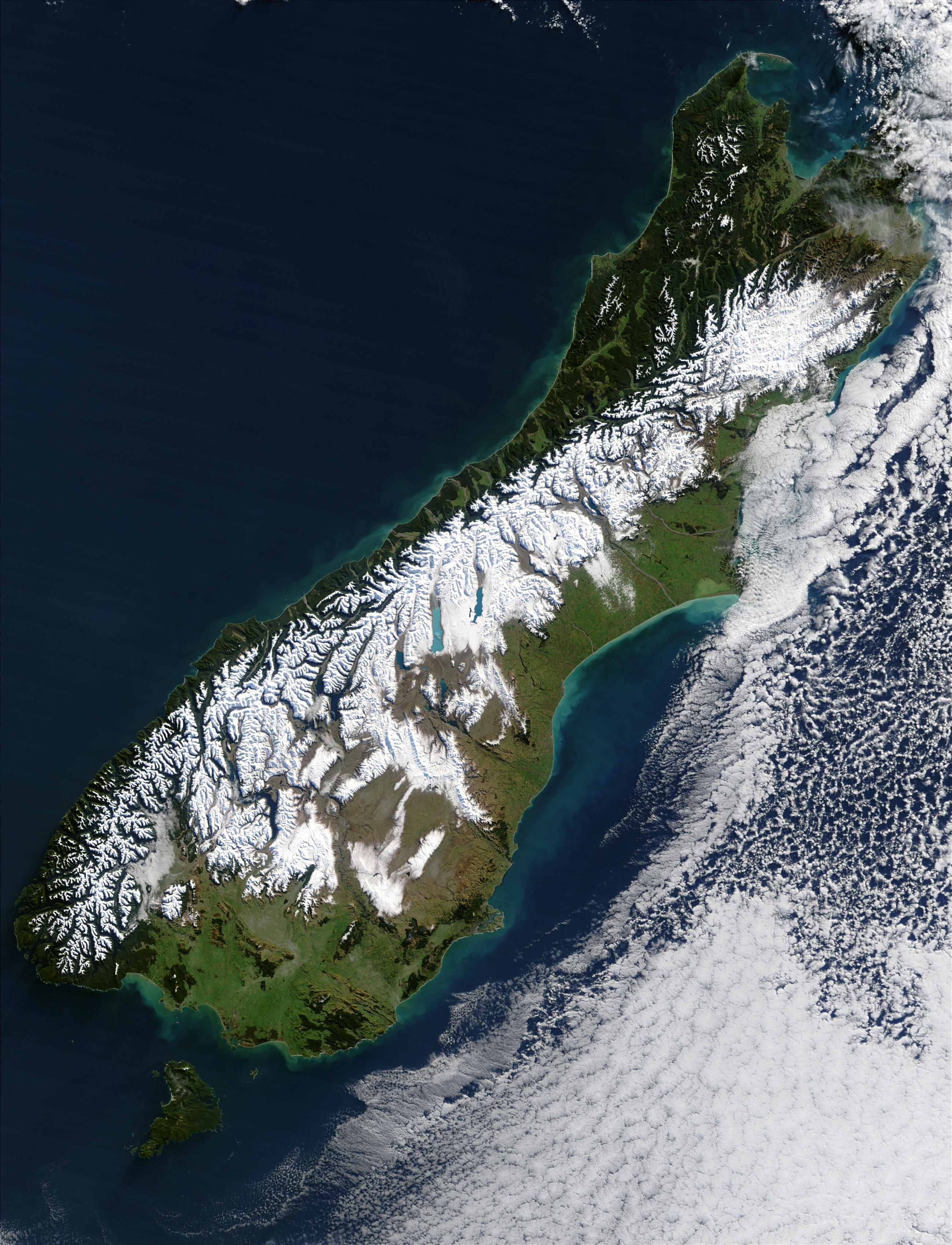
To get a little more into the geological nitty-gritty of this quake, at this point, the magnitude has been placed at 6.8 - a pretty decent showing. It was centered just off the coast of Fiordland (maps here), clearly along the boundary between the Pacific and Australian Plates. This fault, the Alpine Fault, runs from here and forms the nearly linear western boundary of the Southern Alps - see some fantastic evidence of this here, here and here. It's a right lateral fault, but with a lot of oblique motion - the Pacific plate is essentially being thrust over the Australian plate (45 degree dip in places), hence the Alps. It's also the reason why we see these two moment tensor solutions - both indicating convergence along a SW-NE plane. Hmmm...funny how these things have a way of working themselves out. It's a good feeling, really.

Alright, that's enough from me. The USGS page on this quake can be found here, and the GNS one here. Check out some of the accompanying maps and other goodies - they're good times. Also, more on the Alpine Fault from our friends at the Otago Geology Dept. Alright, now I really need to sleep...being able to study for my final on Friday - for my metamorphism class, no less - would probably be a nice thing.

Saturday, September 29, 2007

Geology Escapades

Last week, I took my only geology field trip of the semester. That's pretty sad for me, because I haven't taken less than three geology field trips in a semester since I've been in college. In fact, by my count, I've been on 14 field trips in just four semesters at Pomona, including 7 overnight trips. That's pretty damn good, especially for such a small department, but that makes just one day trip in a semester a little disappointing.

Of course, I did really enjoy this particular trip, for my 'Metamorphics' class. It's about metamorphic petrology, which is basically looking at rocks which have been deformed over time, and how they became deformed. What's nice is by now, I've taken basically the equivalent of a full semester of metamorphic petrology, including about a half semester back at Pomona, and just over a half semester here at Otago.

For the trip, we drove south from Dunedin as far as Nugget Point, which is at the northern end of the Catlins, a beautiful stretch of coast on the south end of the South Island. You can see why this would be a geologist's paradise: So yeah, that would be layers of rock, but turned so they are completely vertical. Crazy, huh? In fact, they're quite popular among different types of geologists, even. For the paleontologist, there are Jurassic-age bivalve (think clams or scallops) fossils. For the structural geologist, analyzing how this block was rotated is the thing to do. For the metamorphic petrologist, however, this represents the beginning of a type locality for burial metamorphism - a type of metamorphism that often involves only the low pressure and temperatures associated with thick piles of sediments or other rocks. This is something you may see in huge river deltas (think Ganges or Amazon), for instance.

For the slightly more geology-inclined, what we saw at Nugget Point specifically was the very start of metamorphism. Light enough to preserve fossils, but just enough to begin the process of zeolitization - the transition from diagenesis (cementing of sedimentary rocks) to the zeolite facies. The rocks - in this case composed of volcanigenic sediments - appear essentially unchanged; we even found some of those fossils in it. As the day moved on, we moved 'up sequence,' with metamorphic grade increasing more and more, until at our last stop we reached greenschist facies (intermediate grade) rock. I've highlighted the rough temperature-pressure conditions that we saw on the trip on the facies diagram above. What made this interesting, besides the pretty consistent increase in grade, was that all of these rocks all had the same mineralogical parent - that is to say, if you melted all of these rocks and analyzed each melt's composition, it would be the same for all the rocks. Pretty cool.